New Developments in North Oakville: A Buyer's Guide
Explore North Oakville's master-planned communities, secondary plans, and growth corridors — a complete guide for buyers researching new homes.
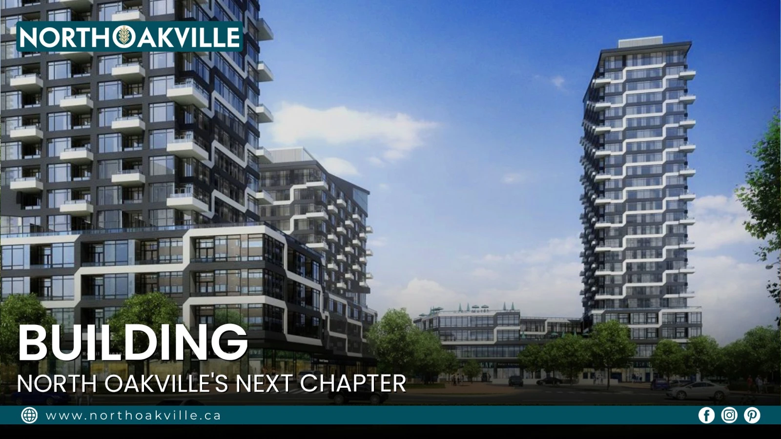
North Oakville has become one of the most significant areas of residential growth in Oakville. Land that was once largely open and agricultural north of Dundas Street is steadily transforming into a collection of established neighbourhoods, new communities, schools, parks, trails, and a growing mix of housing options.
For buyers researching new developments in North Oakville, the area offers something genuinely different from Oakville's older, more established pockets. Growth here is planned on a much larger scale, with entire communities taking shape together rather than individual streets or standalone buildings being added one at a time.
North Oakville is bounded by Dundas Street to the south, Highway 407 to the north, Tremaine Road to the west, and Ninth Line to the east. Growth across this area is primarily guided by the Town's North Oakville East and North Oakville West Secondary Plans, which establish the framework for housing, roads, parks, commercial areas, employment lands, transit, and natural heritage protection.
Understanding How North Oakville Is Structured
Real estate listings often blur the lines between different types of development, which can make North Oakville confusing to research. In reality, the Town organizes growth using four distinct layers:
Secondary Plan Areas — the largest planning framework, set by the Town to guide land use, density, and infrastructure over several decades.
Official Neighbourhoods — broad geographic areas used by the Town to describe and organize communities.
Master-Planned Communities (MPCs) — large, multi-phase developments built out by a single developer or a group of builders following one cohesive design plan.
Builder Projects — individual phases, sub-allocations, or standalone buildings within an MPC, or on an independent infill lot.
Understanding this hierarchy matters because a single "neighbourhood" can contain several master-planned communities, and each of those communities can contain multiple builder-specific phases — all with different housing types, price points, and construction timelines.
The Two Planning Frameworks
North Oakville's growth is governed by two secondary plans, each with a different character.
Planning Area | Geography | Development Focus |
|---|---|---|
North Oakville East Secondary Plan (NOESP) | Ninth Line east to Dundas Street / Sixteen Mile Creek west | The primary engine of high-density growth. Includes the Trafalgar Urban Core, which mandates vertical mixed-use development and transit-supportive infrastructure. Supports some of North Oakville's highest-density residential development, including condominiums, stacked townhomes, and mixed-use areas. |
North Oakville West Secondary Plan (NOWSP) | Sixteen Mile Creek east to Tremaine Road west | Focused on natural heritage preservation alongside low-to-medium density housing. Growth is shaped by the Sixteen Mile Creek valley and an extensive network of protected woodlands, giving the area a lower-density character than the East plan. |
This east-west split is one of the easiest ways to understand why two North Oakville neighbourhoods can look and feel completely different despite being only a few kilometres apart.
Major Residential Neighbourhoods and Communities
The table below maps North Oakville's official neighbourhoods to the master-planned communities and builders active within them.
Neighbourhood | Planning Area | Boundaries | Housing Types | Major Communities & Builders | Development Stage |
|---|---|---|---|---|---|
Glenorchy | NOWSP / NOESP | Dundas St W to William Halton Pkwy; Neyagawa Blvd to Sixteen Mile Creek | Detached homes, freehold townhomes, low-rise condos | The Preserve and Preserve North (Mattamy Homes), Lion Valley Towns (Argo) | Largely built out, with the southern tiers mature and newer edge phases still adding homes |
Joshua's Meadows (Oakvillage node) | NOESP | Dundas St E to William Halton Pkwy; Trafalgar Rd to Eighth Line | High-density condos, stacked townhomes, urban towns | Oakvillage (Minto Communities), Oakville Yards (Daniels/Emshih) | Low-rise portions complete; the area continues transitioning into a higher-density vertical core |
Upper Joshua Creek | NOESP | Dundas St E to Hwy 407; Eighth Line to Ninth Line | Detached, semi-detached, freehold townhomes, mid-rise condos | Joshua Creek Montage, Clockwork & The Laurels (Mattamy), Primont, Hallett, Valery | A major active growth frontier with ongoing low-rise construction and expanding condo nodes |
Burnhamthorpe / Northwest Growth Node | NOWSP | William Halton Pkwy to Hwy 407; Tremaine Rd to Neyagawa Blvd | Low-density detached homes and medium-density master-planned blocks | Ivy Rouge (Rosehaven/Starlane), Oakbrook (Fernbrook/Crystal), Argo Neyagawa | An emerging frontier, transitioning from agricultural land into active community servicing |
A note on naming: "Joshua Creek" refers to the established, mature neighbourhood located entirely south of Dundas Street. All new development discussed above belongs to Upper Joshua Creek, located north of Dundas Street — a distinction that listings and builder marketing don't always make clear.
The Growth Corridors: Roads That Shape Density
North Oakville's layout is organized around a grid of east-west and north-south corridors. Understanding these roads makes the area's development map far easier to read.
East-West Corridors
Dundas Street is the primary commercial and high-density artery forming North Oakville's southern edge. Municipal zoning directs the highest intensification here, with mixed-use condo podiums, retail centres, and a planned rapid transit corridor along the route.
William Halton Parkway is a mid-arterial road engineered to bypass Dundas Street traffic, connecting Tremaine Road directly to Ninth Line. It acts as a structural buffer between earlier low-rise neighbourhoods and the newer northern frontier.
Burnhamthorpe Road runs parallel to Highway 407 along the northern tier and is transitioning from a rural route into an urban avenue, forming the main development frontage for the newest low-to-medium density subdivisions in the town's northernmost sections.
North-South Corridors
Trafalgar Road is the central transit spine of the North Oakville East plan, connecting the area to Oakville GO Station and the QEW. Its intersection with Dundas Street forms the Trafalgar Urban Core, a high-density hub anchored by condo towers and regional commercial space.
Sixth Line runs through the heart of the expanding residential phases and hosts key institutional infrastructure, including newer schools and community facilities, serving as the central spine between Trafalgar Road and Neyagawa Boulevard.
Neyagawa Boulevard is the primary north-south anchor for the western planning sectors. With a more natural, winding character, it borders the Sixteen Mile Creek valley and connects lower-density communities to the town's civic and recreational facilities.
Community Infrastructure Supporting the Growth
New housing in North Oakville doesn't stand alone — it's paired with an ongoing investment in the services and infrastructure that make a neighbourhood livable long-term. It's worth separating what's already in place from what's still on the way, since the two can otherwise blur together.
Community Infrastructure Already Taking Shape
Healthcare: Oakville Trafalgar Memorial Hospital has undergone a major expansion to add acute care capacity, helping the local health system keep pace with the area's growing population.
Schools: The Halton District School Board has been adding new elementary and secondary school capacity in North Oakville to serve the influx of young families.
Parks and recreation: New community centres, libraries, and park facilities have been added across North Oakville's growing neighbourhoods, including expanded sports fields, trail connections, and outdoor recreation space tied to the area's natural heritage system.
Infrastructure Planned for Future Growth
Transit: Dundas Street is planned as a long-term rapid transit corridor connecting communities across the broader region, while Trafalgar Road continues to see upgrades supporting its role as a connection point to Oakville GO Station.
Additional schools: Further school sites along the Sixth Line and Trafalgar corridors are in various stages of planning and construction as the area's population continues to grow.
Commercial space: Municipal planning policy now requires many new developments along the Dundas and Trafalgar corridors to include ground-floor commercial space, so retail, grocery, and medical office space is expected to grow alongside residential density over time rather than lagging behind it.
Because these projects move through funding, construction, and opening stages on their own timelines, buyers evaluating a specific property should always check the Town of Oakville's active development application portal for the most current status on nearby infrastructure.
What Makes North Oakville's Development Pattern Different
The biggest difference between North Oakville and many older suburban communities is how much planning happens before a single home is built. Roads, parks, schools, trails, stormwater systems, and natural heritage areas are considered together as part of one broader community structure, rather than layered in afterward.
More than 900 hectares of North Oakville's natural heritage system have been preserved, including land on both sides of Sixteen Mile Creek. The result is a development pattern where new homes tend to sit close to parks, trails, and open space rather than being surrounded entirely by other houses — a difference that meaningfully shapes how a neighbourhood feels once construction wraps up.
What Buyers Should Check Before Purchasing
North Oakville isn't a single development with one completion date. Different parts of the area sit at different stages, which means the name of a community tells you less than the specific phase and surrounding lands do. Before making an offer, it's worth confirming a few things directly with the Town or your agent:
Whether the specific phase or building is fully approved, under construction, or still in the planning and application stage
Whether nearby vacant land has any active development applications that could affect the neighbourhood in the coming years
Which school catchment the property falls under, and whether any new school sites are planned nearby
Whether upcoming road, transit, or infrastructure projects will run close to the property
Whether a townhome or condo carries Parcel of Tied Land (POTL) or condo fees, and what those fees cover
A home advertised as being in an "established" North Oakville neighbourhood may still sit close to future construction, new roads, or community facilities that haven't broken ground yet — none of which shows up in a single site visit.
Final Thoughts
New developments in North Oakville continue to reshape the way Oakville grows as a whole. From The Preserve and Glenorchy in the west, to Upper Joshua Creek and Oakvillage in the east, different communities are developing at different speeds and with different housing styles — and that variety is exactly what makes the area worth understanding in detail rather than at a glance.
Some neighbourhoods here are already established. Others are still adding new homes, and several projects remain in the planning and approval stages. For buyers, the real advantage of understanding North Oakville is being able to look past any single house or builder and consider the bigger picture — the surrounding development plans, nearby parks and schools, transportation corridors, and the long-term direction of the neighbourhood all shape what living there will actually feel like.
That broader perspective is what makes North Oakville one of the most interesting areas to watch for anyone exploring new homes and communities in Oakville.
FAQs
What's the difference between a Secondary Plan, an Official Neighbourhood, and a Master-Planned Community?
A Secondary Plan is the Town's decades-long framework for an entire region. An Official Neighbourhood is a smaller geographic sector within that plan, used for things like school boundaries. A Master-Planned Community is a specific multi-phase development built by one developer or builder group within a neighbourhood.
What are the main new development areas in North Oakville?
The major growth areas include Glenorchy (home to The Preserve and Preserve North), Joshua's Meadows and the Oakvillage node, Upper Joshua Creek, and the Burnhamthorpe/Northwest growth node around Sixth Line.
What's the difference between Joshua Creek and Upper Joshua Creek?
Joshua Creek is the established, mature neighbourhood south of Dundas Street. Upper Joshua Creek, north of Dundas Street, is where the area's active new development is taking place — a distinction that listings don't always make clear.
Are there different types of new homes available in North Oakville?
Yes. Depending on the specific community, buyers can find detached homes, semi-detached homes, freehold townhomes, stacked and urban townhomes, low-rise condos, and higher-density condominium developments.
Is all of North Oakville still under construction?
No. Some communities, like the southern tiers of Glenorchy, are well established and largely built out, while other areas — particularly Upper Joshua Creek and the Burnhamthorpe growth node — continue to see active construction and new planning applications.
What roads are most important for understanding North Oakville's development?
Dundas Street, Trafalgar Road, Sixth Line, Neyagawa Boulevard, William Halton Parkway, and Burnhamthorpe Road are the key corridors shaping how density and housing type are distributed across the area.
Will North Oakville continue to grow?
Yes. North Oakville is part of Oakville's long-term growth planning framework, with the Town continuing to approve new development applications and expand supporting infrastructure as the population grows.